6 July 2010
Gizo & Ranonga
One morning in 2 April 2007, we woke up at home in Cairns. By force of habit, even before breakfast, I turned on the computer and checked BOM, the Australian Bureau of Meteorology, for the day’s weather. There was a tsunami warning button in red. Blink, blink. Huh? As we had never seen this before, we clicked red button and it warned of a tsunami hitting the Australian East Coast by 9:45 am! What the . . . ? We lived by the sea so, with bleary eyes at 9:20 am, we evacuated – packed our computers, important papers and hard drives into our van and drove up the hill of Yorkeys Knob, our little suburb. We were in good company as almost the entire community was up the knob that morning. Thankfully, the tsunami never hit the Pacific side of the Australian coast.
But on this morning, an 8.1 earthquake hit the Western Province of the Solomon Islands. It was 8am Solomon time and it went on for about 1 – 2 minutes. Gizo, the Western Provincial Capital with a population of about 6,000 was one of the worst hit during the earthquake which triggered an immediate tsunami with destructive waves of up to 5 meters (16 feet) high. Gizo, 45 kilometres from the epicenter, displaced 1,500 people. The tsunami killed 52 (26 children and 26 adults) from 10 villages.
A pretty massive island called Ranonga, located west of Gizo, uplifted by 3 meters. The Ranonga villagers saw their coastal waters go away and the water never came back. The shallow coral reefs that were fishing and gleaning areas are now exposed to air. The coral reefs are now sticking out of the water. The coast is now an instant drop off.
Two months after this calamity, WWF Solomon Islands along with WorldFish Center (used to be known as ICLARM) did an after the earthquake assessment of the damage done to the islands hardest hit by the tsunami.
First on our “to do” list in the Solomon Islands once we got an overview of their marine work was to visit Ranonga Island. To see entire coral reefs as dry land and out of the water was an absolute must and off we went to Gizo and by banana boat, to Ranonga. It was windy, the waves were big and Ranonga Island was not visible from Gizo, but we were in the supremely capable hands of Tengo, WWF SI’s Marine Assistant. We finally reached Ranonga an hour into the trip and the first thing we saw upon hitting the shores were these amazing images:
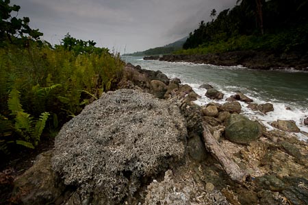
Intact coral heads dry and part of the land. The rugged Ranonga coastline lifted 3 meters after the earthquake of April 2, 2007
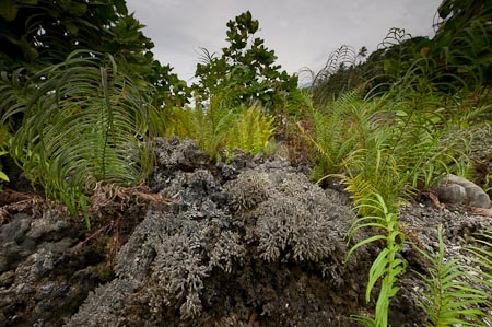
What used to be the coral reef where the locals fished is now a dry reef overgrown with vegetation
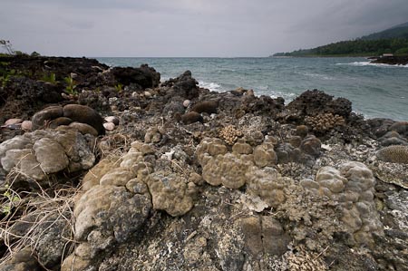
This was a totally new experience for us, walking on dry reef, hating the feel of corals crunching under our feet!
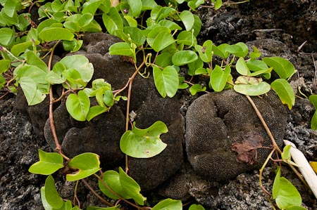
Where fish used to swim now vines replaced. It was like a coral reef cemetery of sorts . . .
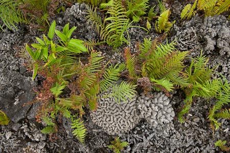
. . . and yet in a surreal sense, it was beautiful . . .
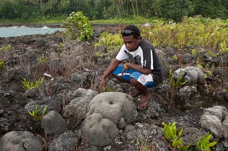
WWF SI’s Bill Apusae who coincidentally comes from Ranonga told us that in this island, one woman died and one boy was buried, never to be found again
If you want to keep updated with our new expedition blog entries, please sign up to our RSS feed by clicking here or clicking on the “Subscribe to this blog!” link at the top right of this page.
And to look up past entries, go all the way down and click into << older posts. Or go to the Archives on the upper right column of this page.

